Configure This View
To configure this view
1. Configure the coordinates for items in Configure Data.
a. If needed, change the path to the items you want to map in Select Dataset.
b. Set the field(s) that provide coordinates for each item:
Choose Latitude and set both the latitude and the longitude.
Or choose Point and select the field that contains a full valid location.
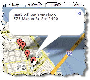
2. If you want to have tooltips with additional information for the mapped item markers, complete the Infobox Template step. For example:
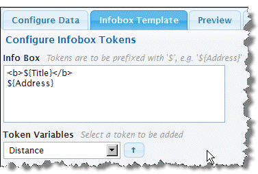
Build a template for the content that should appear in the marker. Template combine tokens, in the form ${path/to/field/data}, that identify fields from each item to supply data for this item, literal characters and optionally HTML markup. Templates can contain multiple lines, as needed. For example:
a. If needed, delete the default token.
b. Enter literal characters wherever you want within the overall template. If you need multiple lines, simply start a new line where needed.
c. To add data from fields in the item, select the path to the field you want and click

.
d. Add HTML markup as raw tags, such as <b>This will be bold</b>.
e. Continue adding literal characters, HTML markup and tokens until you are satisfied with the template.
3. Preview and save the view.